Your challenge, should you choose to accept is...
MAKE COOL SH*T
(...that uses the Jetsam API in some way)
Hold up a sec
- What's a "Jetsam"?
- Jetsam is a Portsmouth based environmental tech startup. We make cool stuff for tracking environmental issues, and then give it to the community for free. Everyday folk can use our apps & devices to take part in citizen science and get a better understanding of the world around them
- You just want us to make something cool?
- Heck yeah. Almost everything that Jetsam makes comes as the result of long conversations spent chilling and chatting over a coffee or two. Why would we ask you to do anything different? Grab someone to talk to (bonus points if it's the first time you've met them!), have a quick chat about what things you wish someone would sort out, and get cracking
- I'm sold! Where do I start?
- That was easy! Have a read through the Developer Documentation to get an idea of what you can do. For the most part, the API is a way of storing, retrieving, and aggregating data from lots of different devices. We mostly use it for tracking pictures of plastic waste, but it also supports a variety of different data types such as wind speed, atmospheric pressure, temperate, and more
But I can't come up with any ideas
We've all been there. Have a look at some of these half-baked ideas and see where your imagination takes you!
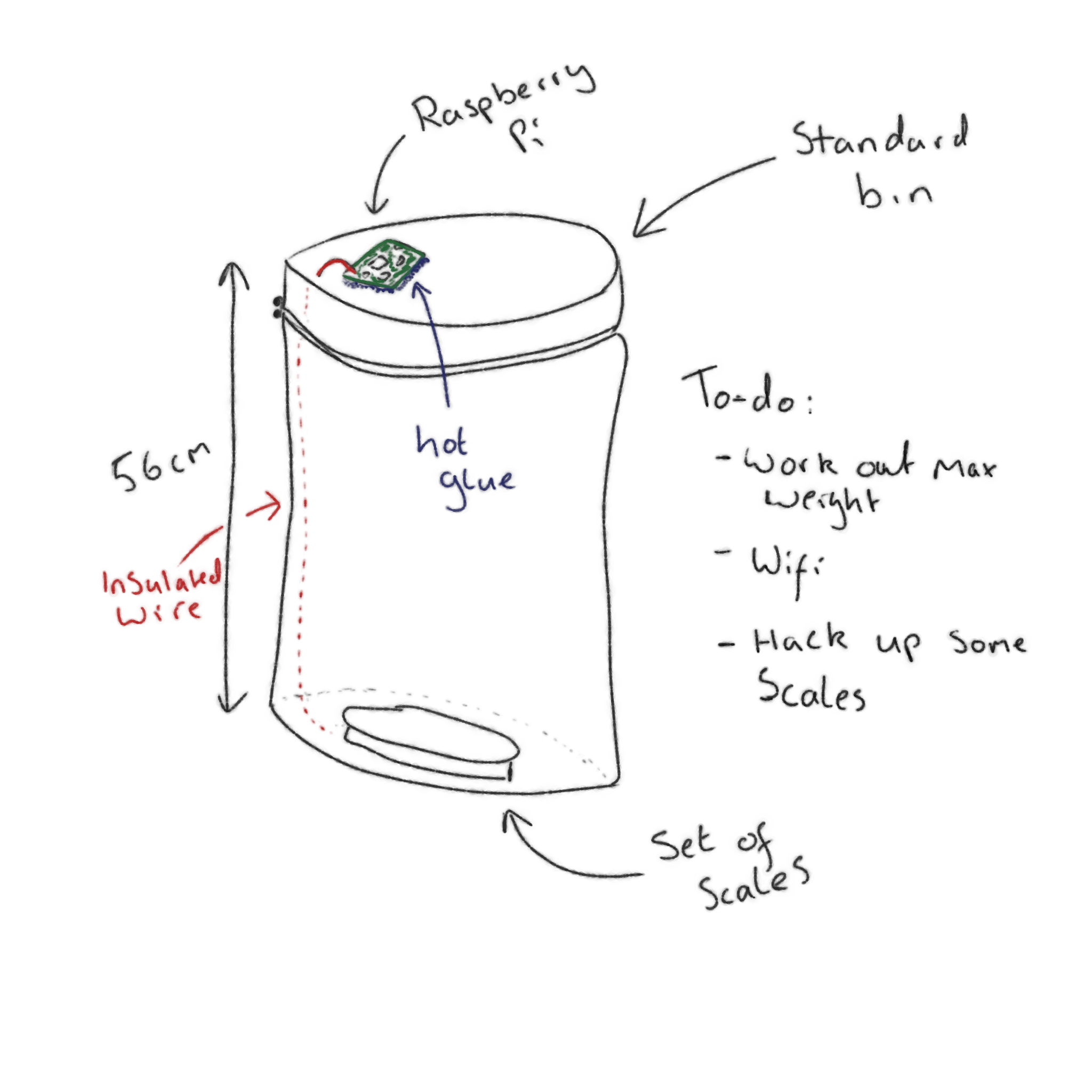
A self-weighing rubbish bin
Basically just a bin with a set of scales hooked up to the Jetsam API. It could send information about how much waste it contains every half an hour or so, using the Create a metric endpoint with the custom_number type and a pre-programmed static location.
How is this useful?
If you put these in public places, you could keep track of how well utilised the bins are at different times of day. Analyse that data over a longer period of time, and you can start to map out more optimal locations for bins in order to stop our rubbish from entering the environment in the first place!
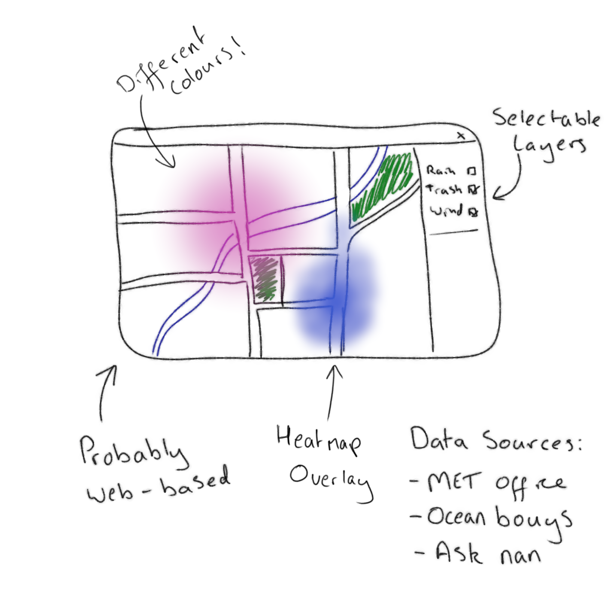
A Weather Map
No, really! The main focus of our app is to gather the locations of plastics through the use of photography. We have a general understanding that all sorts of factors affect the flow of plastics around our cities (wind, rain, human events, natural phenomena), but we have yet to analyse the correlation of all of these factors on the location data that we collect.
You could perform a couple of queries to fetch aggregate metric data tagged astrash, and then overlay some met office weather data. Provide some controls for stepping through time, and you've got the start of a neat analysis app!
How is this useful?
Making data analysis more accessible to the community is a big goal of ours - we're excited to support any efforts to push that forwards
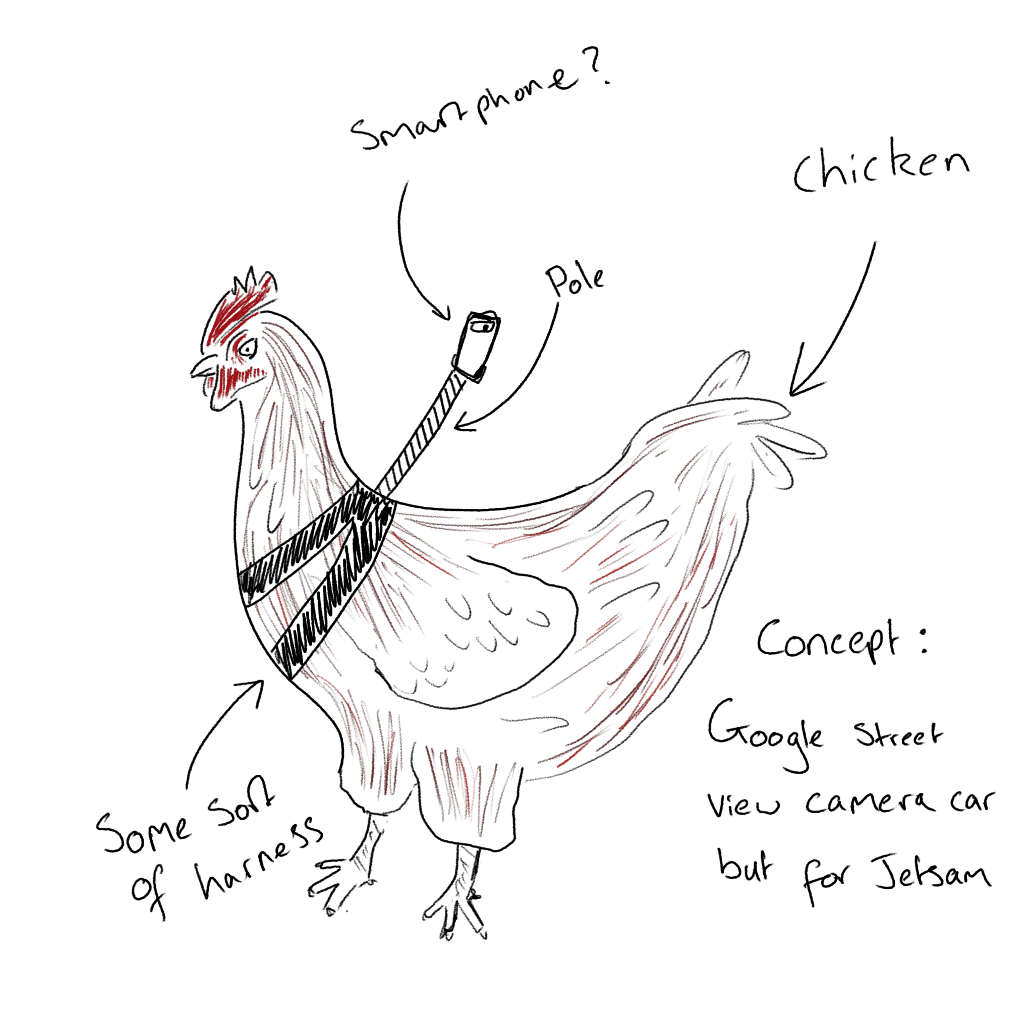
Autonomous Jetsam Camera
What's better than a human using the app to catalogue plastic waste? An app that does it all by itself!
Maybe this one needs a bit longer to simmer...
How is this useful?
Ummm...